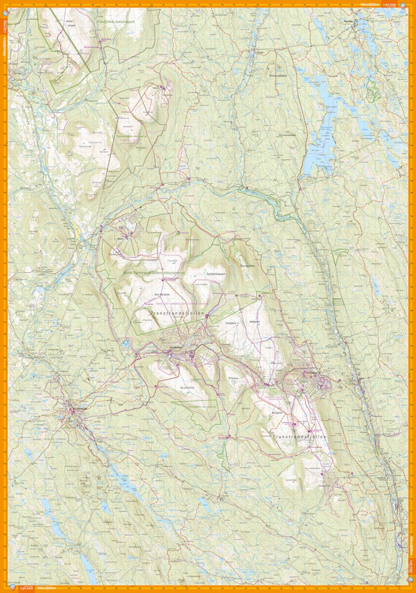
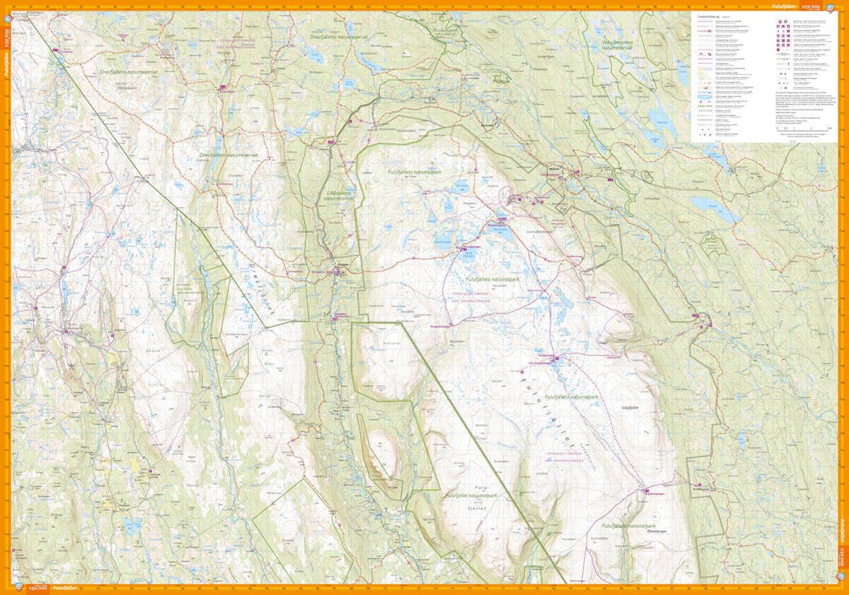
This map is one of the maps we call the new generation mountain map. It means a wealth of detail that is not found in other maps of the same area. The terrain information is based on airborne laser scanning. In addition to completely new height curves with an equidistance of 10 meters, watercourses and slopes appear in a significantly better way than before. The trails are reproduced with greater accuracy, as are sinkholes, buildings, rocky ground and difficult-to-reach vegetation. Large section with Sälenfjällen on one side and Fulufjället national park on the other side, two maps in one if you compare it with the Land Survey's previous section. But also more details that clearly marked groomed ski tracks, the mountain bike trails around Rörbäcksnäs (which can really be recommended, among the best in the country), cabin service etc. We have come to the conclusion that the best material for a map is Tyvek®. It is made of a synthetic fiber that makes the map completely insensitive to water and very tear-resistant. A Tyvek map will not tear in the folds or lose color when you use it.